


Allen Voting District, Worth County, Missouri
About
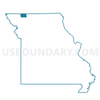
Outline

Summary
| Unique Area Identifier | 611594 |
| Name | Allen Voting District |
| County | Worth County |
| State | Missouri |
| Area (square miles) | 46.90 |
| Land Area (square miles) | 46.88 |
| Water Area (square miles) | 0.02 |
| % of Land Area | 99.96 |
| % of Water Area | 0.04 |
| Latitude of the Internal Point | 40.42257030 |
| Longtitude of the Internal Point | -94.28429140 |
Maps


Graphs
Select a template below for downloading or customizing gragh for Allen Voting District, Worth County, Missouri


Neighbors
Neighoring Voting District (by Name) Neighboring Voting District on the Map
- Bogle/Gentry Voting District, Gentry County, MO
- Fletchall East Voting District, Worth County, MO
- Howard/Lone Star Voting District, Gentry County, MO
- Middlefork Voting District, Worth County, MO
- Smith Voting District, Worth County, MO
- Wesley Voting District, Harrison County, MO
Top 10 Neighboring County Subdivision (by Population) Neighboring County Subdivision on the Map
- Fletchall township, Worth County, MO (1,072)
- Dallas township, Harrison County, MO (218)
- Bogle township, Gentry County, MO (210)
- Middlefork township, Worth County, MO (201)
- Allen township, Worth County, MO (165)
- Smith township, Worth County, MO (153)
- Washington township, Harrison County, MO (112)
- Lincoln township, Harrison County, MO (105)
- Howard township, Gentry County, MO (100)
Top 10 Neighboring Place (by Population) Neighboring Place on the Map
Top 10 Neighboring Unified School District (by Population) Neighboring Unified School District on the Map
- South Harrison School District, MO (5,688)
- Albany R-III School District, MO (2,851)
- Worth County R-III School District, MO (2,216)
- North Harrison R-III School District, MO (1,436)
Top 10 Neighboring State Legislative District Lower Chamber (by Population) Neighboring State Legislative District Lower Chamber on the Map
Top 10 Neighboring State Legislative District Upper Chamber (by Population) Neighboring State Legislative District Upper Chamber on the Map
Top 10 Neighboring 111th Congressional District (by Population) Neighboring 111th Congressional District on the Map
Top 10 Neighboring Census Tract (by Population) Neighboring Census Tract on the Map
- Census Tract 9601, Gentry County, MO (2,992)
- Census Tract 9502, Harrison County, MO (2,355)
- Census Tract 9601, Worth County, MO (2,171)